About Andrew Cusack
 Writer, web designer, etc.; born in New York; educated in Argentina, Scotland, and South Africa; now based in London.
 read more
News
Blogs
Reviews & Periodicals
Arts & Design
World
France
Mitteleuropa
Knickerbockers
Argentina
The Levant
Africa
Cape of Good Hope
Netherlands
Scandinavia
Québec
India
Muscovy
Germany
Academica
Thomas More’s London
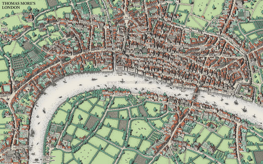
There are almost as many Londons as there are Londoners. There’s Shakespeare’s London, Pepys’s London, Johnson’s London — even fictional characters like Sherlock Holmes have their own London.
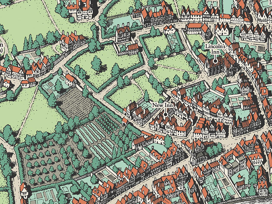
The city of Saint Thomas More takes form in a representation made by the excellent map designer Mike Hall, Harlow-born but now based in Valencia.
This map was commissioned from Hall by the Centre for Thomas More Studies in Texas and the designer based the view and the colour scheme on Georg Braun and Frans Hogenberg’s map of London from their 1617 Civitates Orbis Terrarum
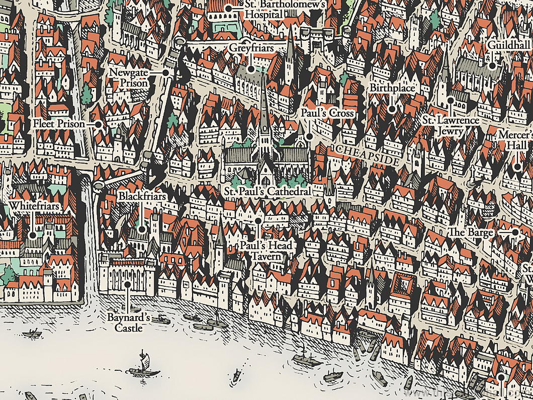
From his birthplace in Milk Street to the site of his execution, all the sites from the great points of More’s life are here in this map.
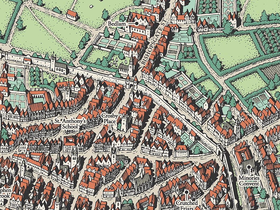
The future Lord Chancellor was educated at the school founded by the Hospital Brothers of Saint Anthony, one of the best in the City of London, and when he finished at Oxford returned to London to study law at New Hall and Lincoln’s Inn.
Crosby Place, the house that he bought in 1523 is not far from St Anthony’s School though its surviving remnant was moved brick by brick to Cheyne Walk in 1910 — a site close to More’s Chelsea residence of Beaufort House.
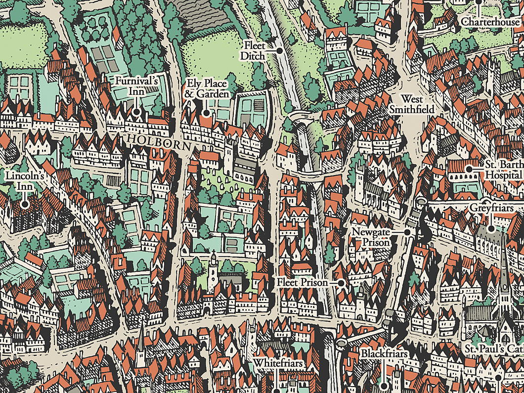
The chapel of Ely Place — town palace of the Bishop of Ely — still survives as St Etheldreda’s, the only mediæval church in London now in use as a Catholic parish.

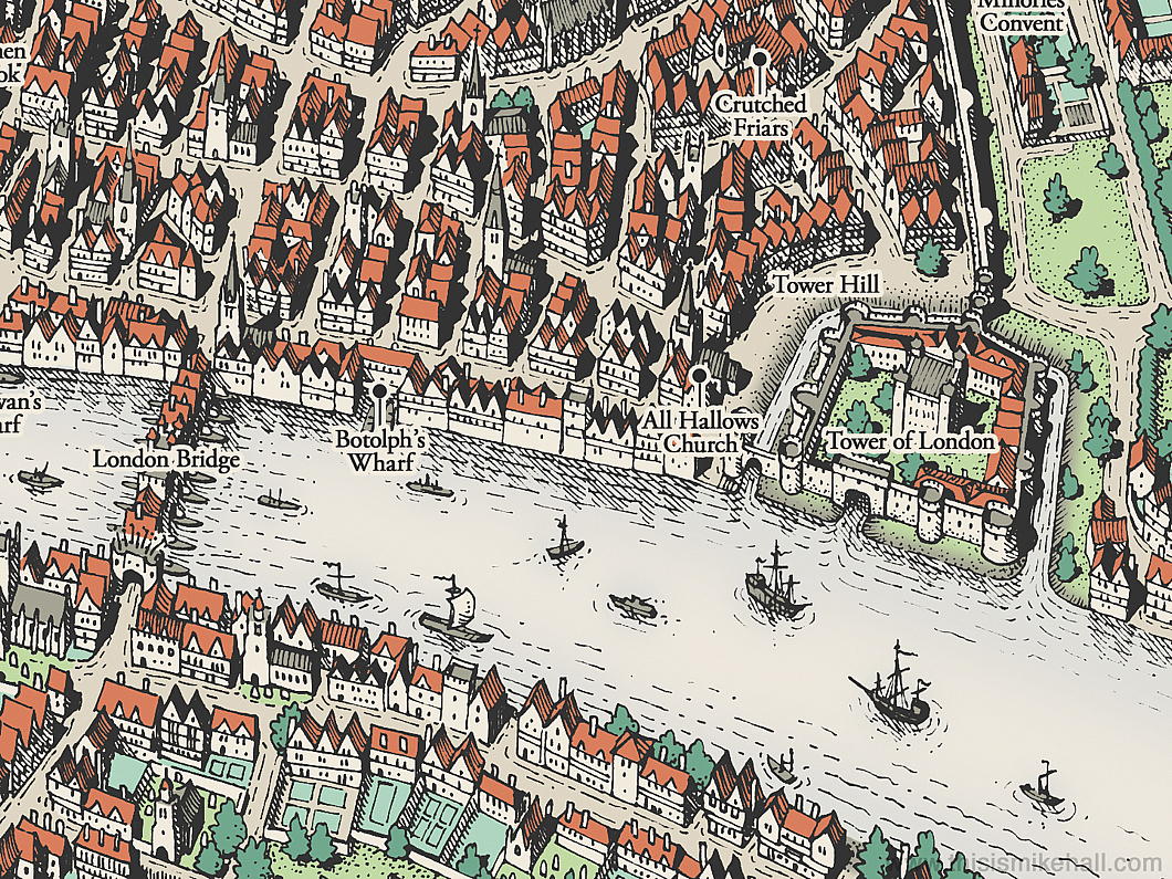
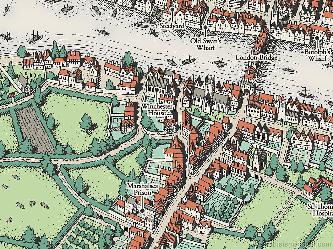
God’s own Borough of Southwark gets a look in as well, with the Augustinian priory of St Mary Overs (now the Protestant cathedral of Southwark) and the town palace of the bishops of Winchester. Remnants of the great hall of Winchester Palace remains standing to this day.
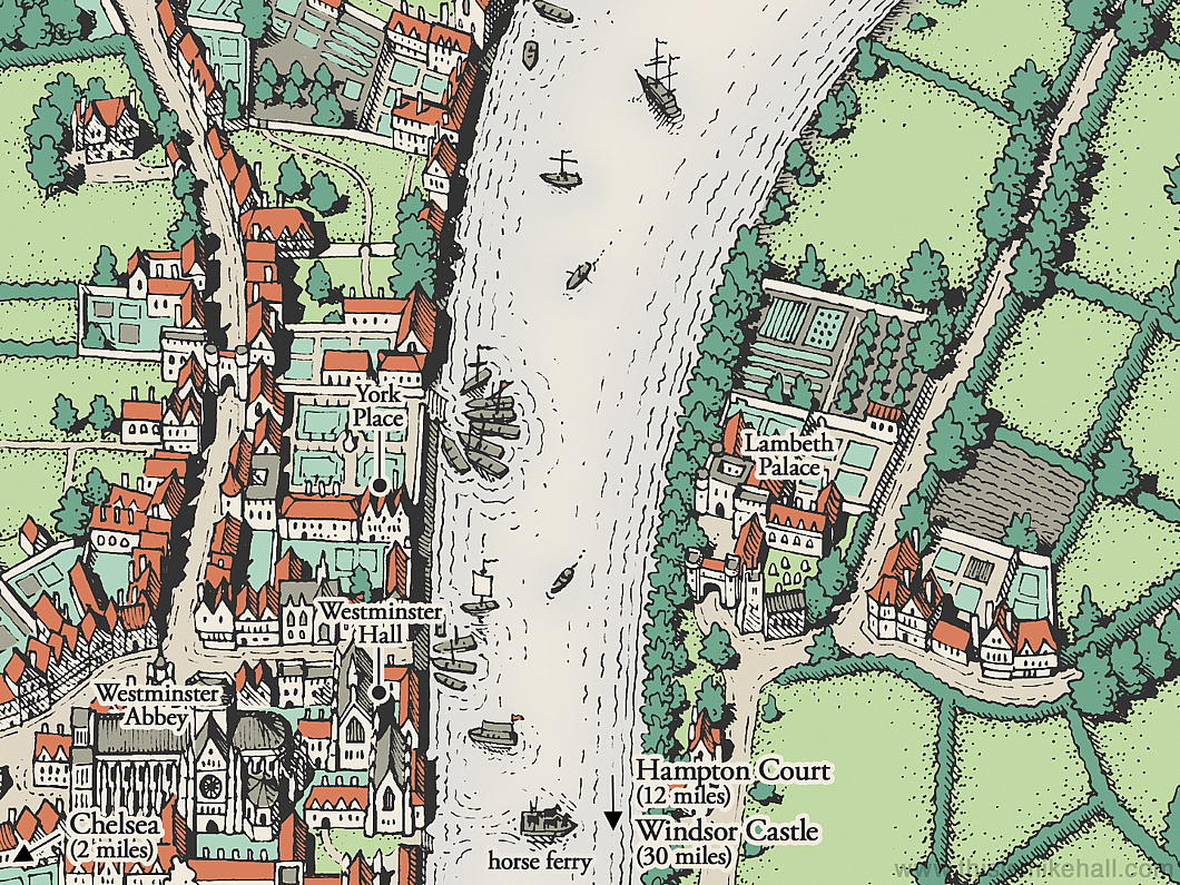
As is the mapmaker’s privilege, Mr Hall has taken some liberties: in order to fit Lambeth Palace — the residence of the Archbishop of Canterbury (and Primate of All England) he’s shifted it a bit north of its actual spot.
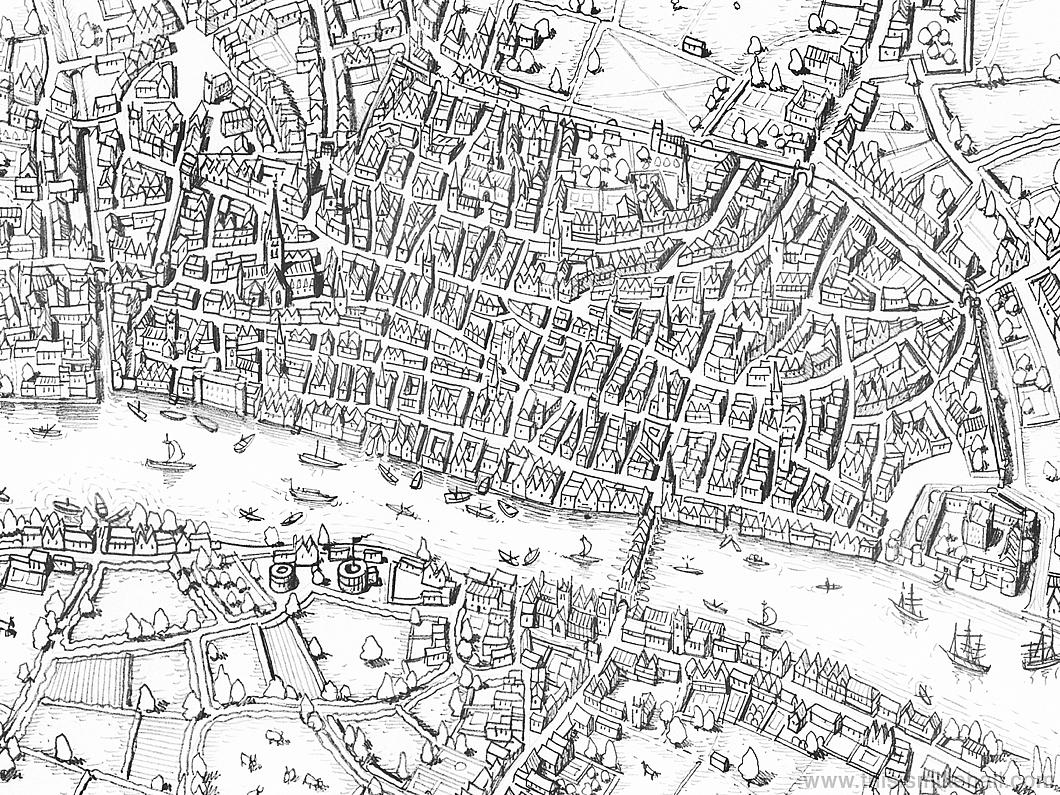
I wish he’d kept the Rose and Globe theatres which he included in his initial sketch for the map — Southwark was the theatre district of its day.
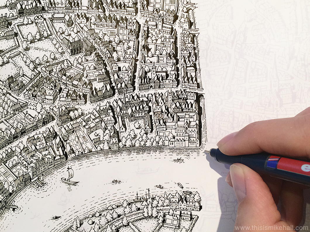
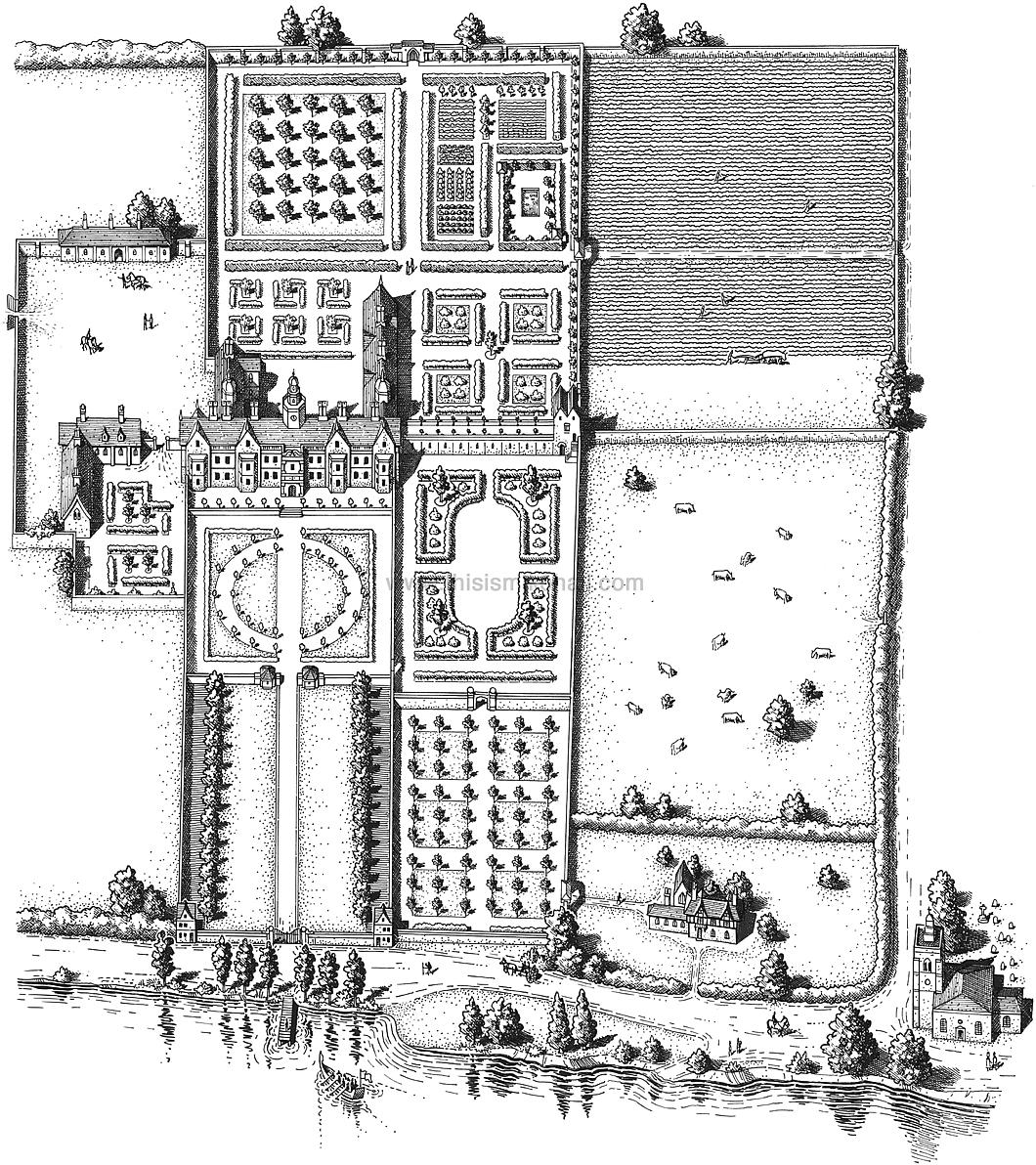
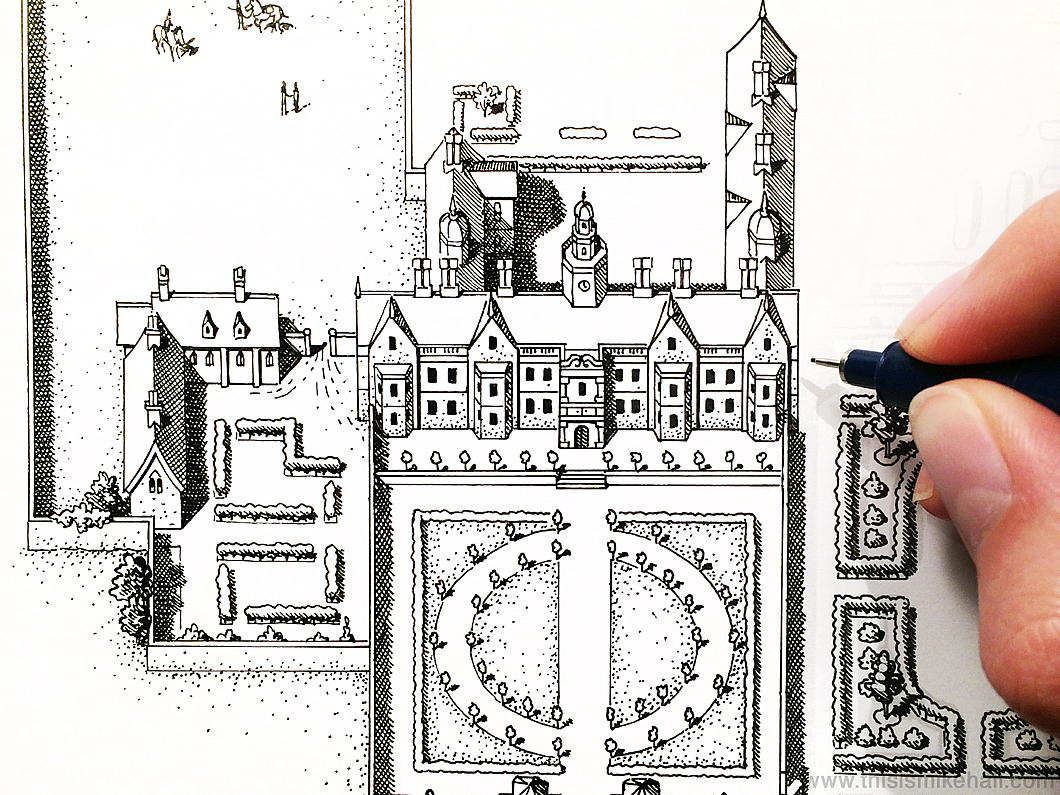
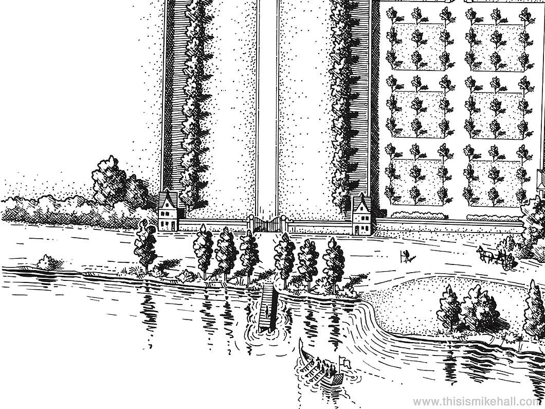
Hall also completed a sketch of Beaufort House as it would have appeared during St Thomas More’s lifetime. The house was demolished in 1740, and today’s Beaufort Street runs the line of the main drive leading up to it.
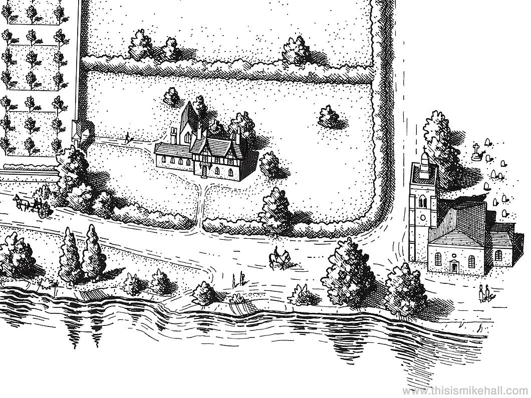
The Church of All Saints at Chelsea (now known as Chelsea Old Church) is at the bottom of the sketch and is where the More family burial vault is. His severed head is believed to be entombed there to this day.
Search
Instagram: @andcusack
Click here for my Instagram photos.Most Recent Posts
- Articles of Note: 11 November 2024 November 11, 2024
- Why do you read? November 5, 2024
- India November 4, 2024
- The Lithe Efficiency of the Old Constitution November 4, 2024
- Waarburg October 2, 2024
Most Recent Comments
Book Wishlist
Monthly Archives
Categories

